Home USA WY
KWRL

Worland Municipal Airport (WRL) | Terminal maps | Airport guide
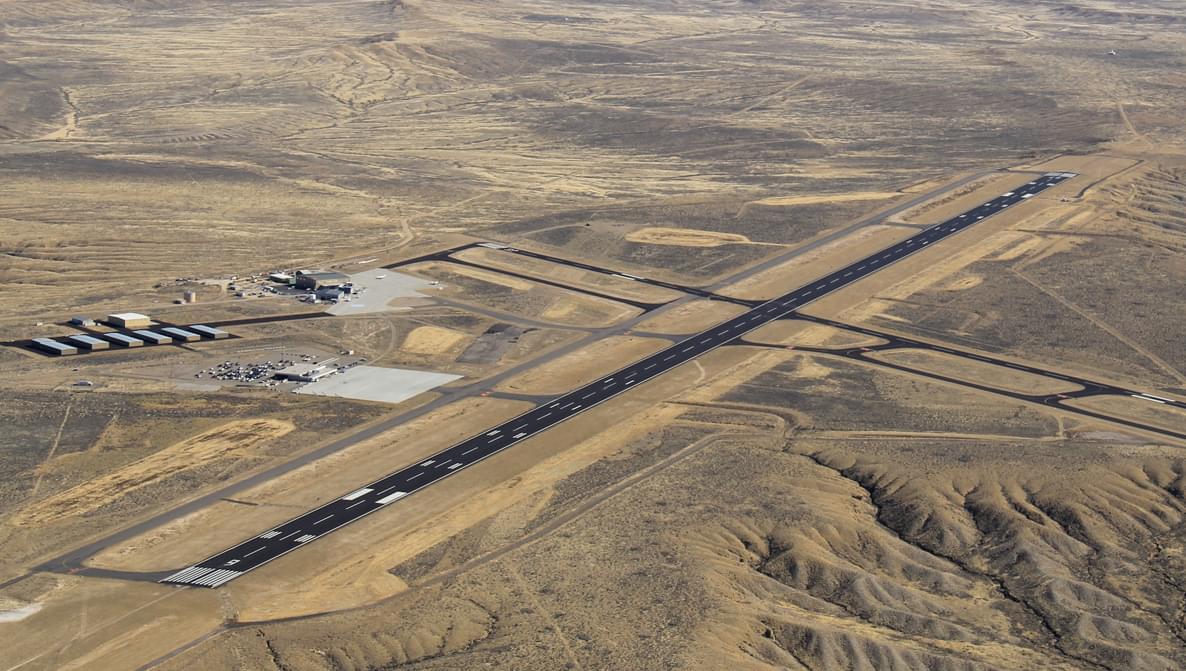
Worland Municipal Airport (WRL) Map

Scroll down for more airport maps and info


Worland Municipal Airport Weather 05/19/2024

Weather Forecast
Sunny

Tonight

43

Mostly Cloudy

Sunny

Sunday

69

Mostly Sunny then Mostly Sunny and Breezy

Sunny

Sunday Night

42

Partly Cloudy and Breezy then Mostly Cloudy

Sunny

Monday

59

Chance Showers then Showers Likely

Sunny

Monday Night

41

Showers

Sunny

Tuesday

54

Showers Likely

Sunny

Tuesday Night

37

Chance Showers then Partly Cloudy

Sunny

Wednesday

66

Mostly Sunny then Slight Chance Showers

Sunny

Wednesday Night

42

Slight Chance Showers

Sunny

Thursday

63

Slight Chance Showers then Chance Showers

Sunny

Thursday Night

39

Chance Showers

Sunny

Friday

63

Chance Showers

Sunny

Friday Night

40

Slight Chance Showers then Partly Cloudy

About Worland Municipal Airport

The Worland Municipal Airport (WRL), located in the heart of Wyoming's Big Horn Basin, serves as a vital transportation link for Worland and surrounding communities. The airport provides connections to major regional and national destinations, primarily through Denver Air Connection's daily flights that take passengers directly to Denver. This service is critical to the local economy, providing business travel, tourism, and giving residents access to broader air transportation networks. WRL amenities include parking, car rental services and a passenger terminal designed for convenience and efficiency, providing a seamless travel experience. The Worland Municipal Airport plays a key role in enhancing the region's accessibility and supporting its development.

Worland Municipal Airport Information

WRL Contact Information

Name:
LYNN MURDOCH
Address:
1438 AIRPORT ROAD
Telephone:

Worland Municipal Airport Maps

WRL Airport map


WRL Airport diagram

Worland Municipal Airport Ground Transportation


Worland Municipal Airport Rental Cars

Hertz Rent-A-Car - Municipal Airport
Hours of Operation:
24 Hours, 7 Days a Week
Open For Final Arrival:
Yes

1456 Airport Road, Worland

(208) 736-6281

Worland Municipal Airport Parking

WRL - Parking

1472 Airport Rd, Worland, WY 82401, United States, Worland

(307) 347-8977

Worland Municipal Airport Hotels

BEST WESTERN PLUS The Plaza Hotel

This Thermopolis, WY hotel is within walking distance of all the Hot Springs State Park attractions including the Swinging Bridge, State Bath House, Rainbow Terraces and Buffalo Pasture. Visitors of this Wyoming Best Western also explore the area by reveling in the sights of Wind River Canyon, Boysen Lake and Reservoir and Legend Rock Petroglyph Site.

Distance from Airport:
Distance from Airport 25.0 miles
Free Airport Shuttle:
No

116 E Park St, WY, Thermopolis, 82443-2440

(307) 864-2939

Rainbow Motel

For clean, quiet and comfortable rooms come stay with us and see why we are the favorite of families with our large family rooms which sleep 6 and our 2 bedroom suites. All our rooms are completely non-smoking and we do not allow pets. Be assured of super clean rooms, TV's with 55 ch cable, refrigerator, microwave, wireless internet, and high quality beds.

Distance from Airport:
Distance from Airport 25.0 miles
Free Airport Shuttle:
No

408 Park Street, WY, Thermopolis, 82443-2232

(307) 864-2615

Comfort Inn

Nestled in the Bighorn Basin between the Bighorn Mountains and Owl Creek Mountains, the 100 percent non-smoking Comfort Inn hotel in Worland, Wyoming is near many area attractions. The hotel is just minutes from the Washakie Museum. Tourists will enjoy visiting Hot Springs State Park and the Wyoming Dinosaur Center, both only a short drive away.

Distance from Airport:
Distance from Airport 4.0 miles
Free Airport Shuttle:
No

100 North Road 11, WY, Worland, 82401

(307) 347-9898

Airlines Serving Worland Municipal Airport

WRL Charts & Navaids

Latitude:
37-37-07.7000N (37.618806)
Longitude:
122-22-31-5000W (-122.375417)
Elevation:
13.1 feet MSL (4 m MSL)
Magnetic Variation:
13.2 E (as of March 2022 from WMM2020 model)
Time Zone:
UTC -8.0 (Standard Time)
UTC -7.0 (Daylight Savings Time)
From City:
08 N.M. SE of San Francisco, California
Found On:
San Francisco Chart
FAA Region:
AWP
Close
press and move the map