Akron-Canton Airport (CAK) | Terminal maps | Airport guide


Akron-Canton Airport Terminal Guides
View All CAK Guides-
CAK Airport Terminal
Open Guide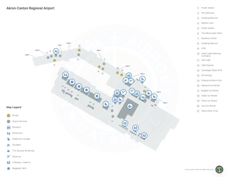
Akron-Canton Airport Information
-
Airport Address:
Akron-Canton Airport 5400 Lauby Rd North Canton, OH 44720 -
Official Website:
http://www.akroncantonairport.com/ -
Contact Number:
(888) 434-2359
CAK Contact Information
-
Name:
RENATO CAMACHO -
Address:
5400 LAUBY RD -
Telephone:
(330) 499-4059
Akron-Canton Airport

Akron-Canton Regional Airport (CAK), located in Greene, Ohio, is a small but very efficient airport serving the Akron and Canton metropolitan areas. Located just off Interstate 77, it is about 14 miles southeast of Akron and 10 miles northwest of Canton, making it a convenient gateway for travelers to Northeast Ohio.
The airport has one terminal, known for its user-friendly design and easy navigation. This streamlining minimizes the stress often associated with large airports and speeds up check-in and security processes. CAK offers flights on several airlines, including American Airlines, Breeze Airways and Spirit Airlines. These carriers provide access to major hubs and popular destinations, facilitating both direct and connecting flights. Akron-Canton Regional Airport amenities include free Wi-Fi, comfortable seating areas, a selection of restaurants and stores, and a business center. Parking is easy: there are options ranging from short-term to long-term parking, and all are located close to the terminal. The airport also places a strong emphasis on accessibility, providing amenities for travelers with disabilities.
CAK stands out for its commitment to carefree travel, combining the convenience and charm of a regional airport with the necessary modern amenities. This makes it a preferred choice for both business and leisure travelers in the region.
Akron-Canton Airport Weather 07/18/2026
Weather Forecast
This Afternoon
86
T-storms
Tonight
62
T-storms then Patchy Smoke

Sunday
78
Mostly Sunny

Sunday Night
55
Patchy Smoke
Monday
80
Mostly Sunny
Monday Night
64
Mostly Cloudy then Chance Showers
Tuesday
82
Showers Likely then T-storms
Tuesday Night
63
T-storms then Showers Likely
Wednesday
72
Mostly Sunny

Wednesday Night
55
Partly Cloudy

Thursday
75
Sunny

Thursday Night
56
Mostly Clear
Friday
79
Sunny