Grand Rapids Airport (GRR) | Terminal maps | Airport guide


Grand Rapids Airport Terminal Guides
View All GRR Guides-
GRR Airport Terminal
Open Guide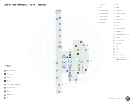
-
GRR Airport Concourse A
Open Guide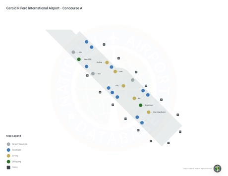
-
GRR Airport Concourse B
Open Guide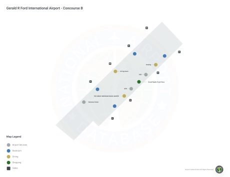
Grand Rapids Airport Information
-
Airport Address:
5500 44th St SE, Grand Rapids, MI 49512, United States -
Official Website:
http://www.flygrandrapids.org/ -
Contact Number:
(616) 233-6000
GRR Contact Information
-
Name:
TORY RICHARDSON -
Address:
5500 44TH ST SE -
Telephone:
(616) 233-6000
Grand Rapids Airport
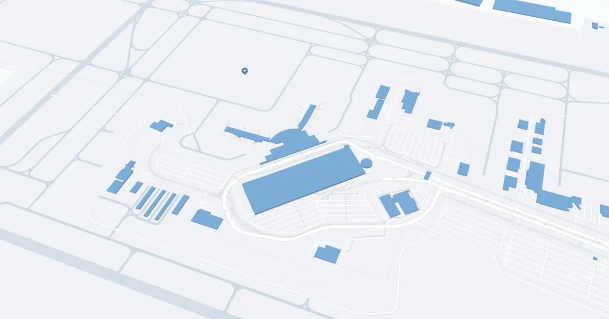
Gerald R. Ford International Airport (GRR), located in Grand Rapids, Michigan, is the second busiest airport in the state and serves as a key gateway to West Michigan.
The airport is served by several major airlines, including American Airlines, Delta Air Lines, United Airlines, Southwest Airlines, Allegiant Air, and Frontier Airlines. These carriers provide direct flights to major hubs and popular destinations throughout the United States, such as Atlanta, Chicago, Denver, Orlando and Dallas, making it easy for passengers to travel both domestically and internationally.
GRR has two terminals equipped with an array of amenities designed to enhance the travel experience. Passengers can take advantage of dining options ranging from quick snacks to full meals, retail outlets offering travel and local merchandise, free Wi-Fi throughout the airport and comfortable lounges. The airport also offers many parking options, including short-term, long-term and economy parking lots conveniently located near the terminals. Car rental services, cab stands and ride-sharing pick-up points are readily available, providing convenient transportation to and from the airport.
Gerald R. Ford International Airport plays an important role for travelers in West Michigan by providing convenient access to global destinations, supporting the local economy through tourism and business travel, and serving as a gateway for residents and visitors. Comprehensive service and strategic location make GRR an important node in the region's transportation network.
Grand Rapids Airport Weather 07/25/2026
Weather Forecast
Tonight
57
Mostly Clear

Saturday
84
Sunny
Saturday Night
68
Partly Cloudy then Slight Chance Showers

Sunday
90
Slight Chance T-storms

Sunday Night
70
Showers Likely

Monday
90
Chance T-storms

Monday Night
67
Chance Showers

Tuesday
85
Mostly Sunny
Tuesday Night
62
Mostly Clear
Wednesday
86
Sunny
Wednesday Night
63
Mostly Clear
Thursday
88
Sunny

Thursday Night
65
Partly Cloudy