Home USA AK
Unalaska Airport (DUT)

Unalaska Airport (DUT)

DUT

Unalaska Airport Information

Airport Address:
429 Airport Beach Rd, Unalaska, AK 99692, United States
Contact Number:

DUT Manager & Contact Information

Name:
DALE RUCKMAN
Address:
PO BOX 920525
Telephone:

About Unalaska Airport

Tom Madsen (Dutch Harbor) Airport (IATA: DUT, ICAO: PADU, FAA LID: DUT) is a state-owned public-use airport in City of Unalaska, on Amaknak Island in the Aleutian Islands, off the coast of the U. S. state of Alaska. It is located near the Bering Sea coast of Unalaska Island, 800 miles (1,300 km) southwest of Anchorage and 1,950 miles (3,140 km) from Seattle. The official name of the City of Unalaska's port is Dutch Harbor. That name is also applied to the portion of Unalaska on Amaknak Island, which is located across a bridge from the rest of the city on Unalaska Island. Therefore, the airport is sometimes referred to as Dutch Harbor Airport. In 2002, the State of Alaska renamed it Tom Madsen Airport in honor of Charles Thomas Madsen Sr. , a bush pilot who was killed in an airplane accident that year. However, the Federal Aviation Administration still refers to it as Unalaska Airport. Scheduled commercial airline service was provided by PenAir, a code share partner of Alaska Airlines until October 2019, and prior to that Alaska Airlines operated Boeing 737-200 Combi jetliners to the airport with these aircraft transporting a combination of passengers and freight on the main deck of the aircraft. However, due to load restrictions as a result of the short runway as well as cancellations due to weather, Alaska Airlines then contracted the service via a code sharing arrangement to PenAir in 2004. PenAir initially operated Saab 340 and then Saab 2000 regional turboprop aircraft into the airport. PenAir went into bankruptcy in 2019 and its assets, including aircraft were acquired by Ravn Alaska, and one of the Saab 2000 formerly operated by PenAir was involved in a fatal accident on October 17, 2019, which resulted in the end of PenAir operating Alaska Airlines code sharing service. Ravn Alaska is now serving the airport using de Havilland Canada DHC-8 Dash 8 aircraft, but without the involvement of Alaska Airlines. AirPac also previously served the airport with British Aerospace BAe 146-100 jets with this aircraft type having enhanced short runway takeoff and landing performance and in 1986 was operating direct, no change of plane jet service to Seattle via stops in Anchorage and Sitka. The airfield runway is 4,100 feet long which is quite short for jet operations when compared with typical runways normally used by mainline jet aircraft. Other airlines that served the airport in the past included MarkAir operating Boeing 737-200 Combi jet aircraft and Reeve Aleutian Airways flying Lockheed L-188 Electra turboprops via a code sharing agreement with Alaska Airlines. As per Federal Aviation Administration records, the airport had 28,234 passenger boardings (enplanements) in calendar year 2008, 26,705 enplanements in 2009, and 26,711 in 2010. It is included in the National Plan of Integrated Airport Systems for 2011 2015, which categorized it as a primary commercial service airport (more than 10,000 enplanements per year).

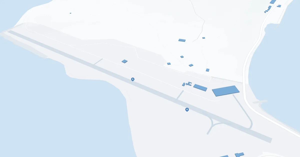
Unalaska Airport Maps

DUT Airport map


DUT Airport diagram

Unalaska Airport Ground Transportation

Learn More

DUT Taxi

Unalaska Airport Rental Cars

Learn More

Williwaw Services

Hours of Operation:
24 Hours, 7 Days a Week
Open For Final Arrival:
Yes

Unalaska Airport Hotels

Learn More

Unisea Inn

UniSea Inn features live entertainment, sports bar, grill and guestrooms for the economy minded travelers on a budget.

Distance from Airport:
Distance from Airport 1.0 mile
Free Airport Shuttle:
No

Royal Dutch Inn

Distance from Airport:
Distance from Airport 2.7 miles
Free Airport Shuttle:
No

Grand Aleutian Hotel

Whether your day takes you out into the icy waters of the Bering Sea, across the flank of Makushin Volcano, or through a labyrinth of exotic seabird colonies, you can always come home to "The Grand." Unwind in our lounge by the fire, dine in our acclaimed Chart Room restaurant, and enjoy well-appointed accommodations as you prepare for the next day's adventure.

Distance from Airport:
Distance from Airport 1.0 mile
Free Airport Shuttle:
No

DUT Charts & Navaids

Learn More
Latitude:
37-37-07.7000N (37.618806)
Longitude:
122-22-31-5000W (-122.375417)
Elevation:
13.1 feet MSL (4 m MSL)
Magnetic Variation:
13.2 E (as of March 2022 from WMM2020 model)
Time Zone:
UTC -8.0 (Standard Time)
UTC -7.0 (Daylight Savings Time)
From City:
08 N.M. SE of San Francisco, California
Found On:
San Francisco Chart
FAA Region:
AWP