Eppley Airfield (OMA) | Terminal maps | Airport guide


Eppley Airfield Terminal Guides
View All OMA Guides-
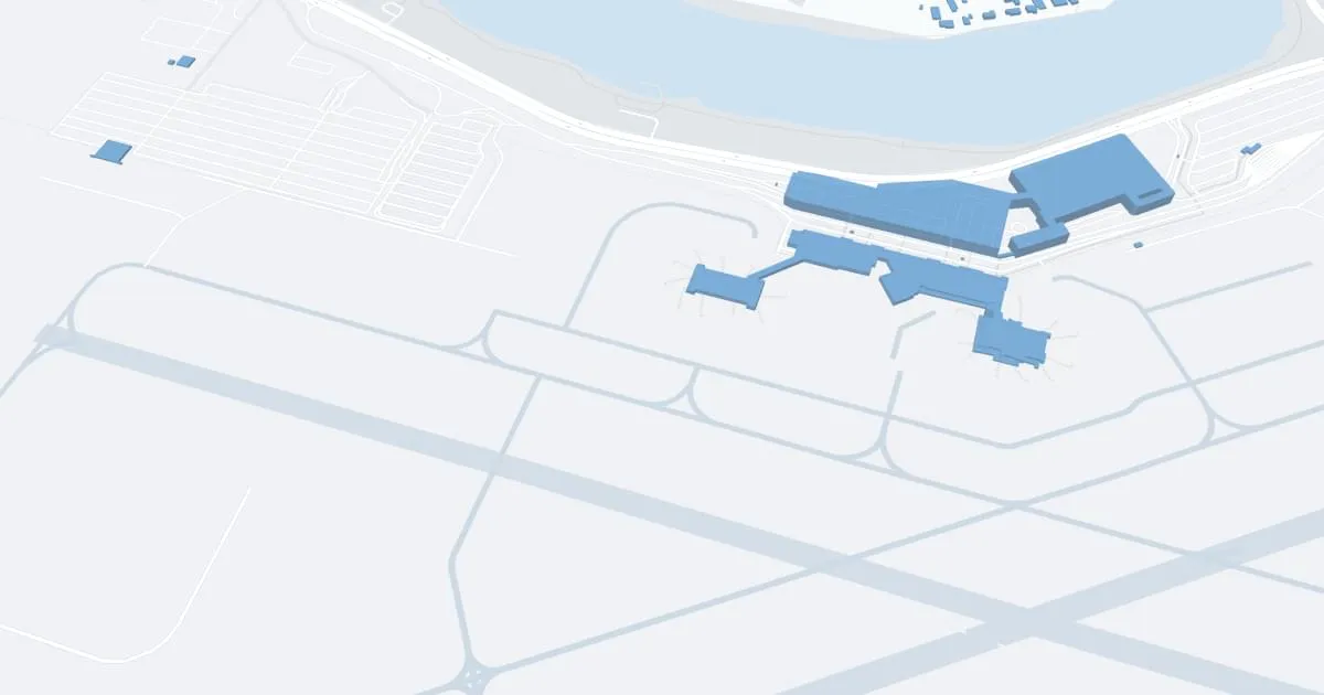
OMA Airport Terminal
Open Guide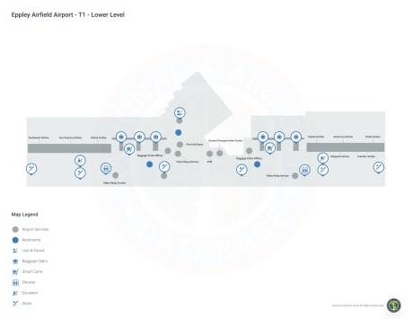
Eppley Airfield Information
-
Airport Address:
4501 Abbott Drive, Omaha, NE 68110, United States -
Official Website:
http://www.flyoma.com/ -
Contact Number:
(402) 661-8017
OMA Contact Information
-
Name:
MR. DAVID L. ROTH -
Address:
4501 ABBOTT DRIVE, SUITE 2300 -
Telephone:
(402) 661-8000
Eppley Airfield
Eppley Airfield (OMA), strategically located in Omaha, Nebraska, is an important gateway to the Midwest, providing extensive connectivity to one of the region's largest cities. This airport is a vital hub for business and leisure travelers, providing access to Omaha's vibrant economy, cultural attractions and historic sites.
OMA is served by several major airlines, including American Airlines, Delta Air Lines, Southwest Airlines, United Airlines, Alaska Airlines, Frontier Airlines, and others. These carriers offer direct flights to major U.S. cities such as Denver, Chicago, Dallas/Fort Worth, Atlanta and Las Vegas, making it easy to access national and international destinations.
The airport has a modern terminal designed for passenger convenience. There are amenities such as ample parking, a comprehensive car rental center, cab and ride-sharing services to provide convenient ground transportation. Inside the airport, travelers can enjoy a variety of restaurants to suit all tastes, stores for shopping, free Wi-Fi to stay connected, and comfortable lounge areas to relax.
Eppley Airfield plays a critical role in supporting the economy of Omaha and the entire Midwest region by promoting tourism, facilitating business travel and providing critical connectivity for residents and visitors. Its strategic location, combined with its wide range of services, makes OMA an indispensable asset to the community, improving connectivity and contributing to the economic development of Omaha and surrounding areas.
Eppley Airfield Weather 07/27/2026
Weather ForecastTonight
80
Partly Cloudy then Slight Chance T-storms

Monday
101
Hot

Monday Night
76
Increasing Clouds

Tuesday
92
Partly Sunny

Tuesday Night
73
Partly Cloudy

Wednesday
93
Mostly Sunny
Wednesday Night
73
Partly Cloudy then Slight Chance T-storms

Thursday
89
Chance T-storms

Thursday Night
71
Showers Likely

Friday
87
Slight Chance T-storms

Friday Night
68
Mostly Clear
Saturday
86
Mostly Sunny
Saturday Night
66
Mostly Clear then Slight Chance T-storms