Sacramento Airport (SMF) | Terminal maps | Airport guide


Sacramento Airport Terminal Guides
View All SMF Guides-
SMF Airport Terminal A
Open Guide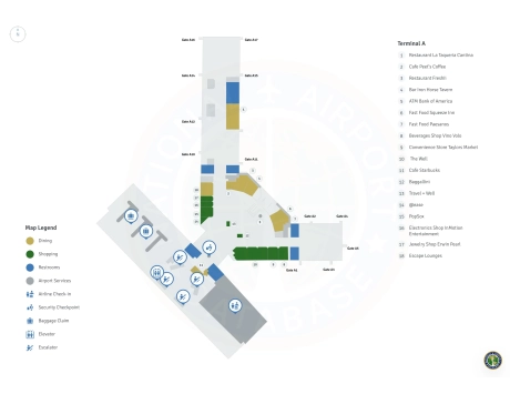
-
SMF Airport Terminal B
Open Guide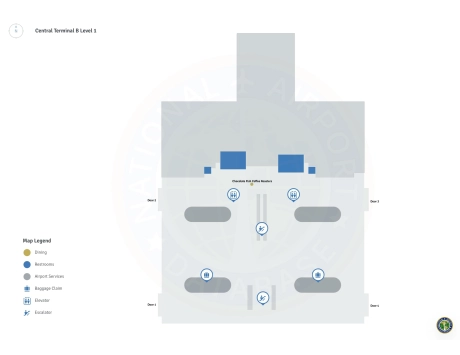
Sacramento Airport Information
-
Airport Address:
6900 Airport Blvd, Sacramento, CA 95837, United States -
Official Website:
https://sacramento.aero/smf -
Contact Number:
(916) 929-5411
SMF Contact Information
-
Name:
SHERI THOMPSON-DUARTE -
Address:
6900 AIRPORT BLVD -
Telephone:
(916) 874-0560
Sacramento Airport
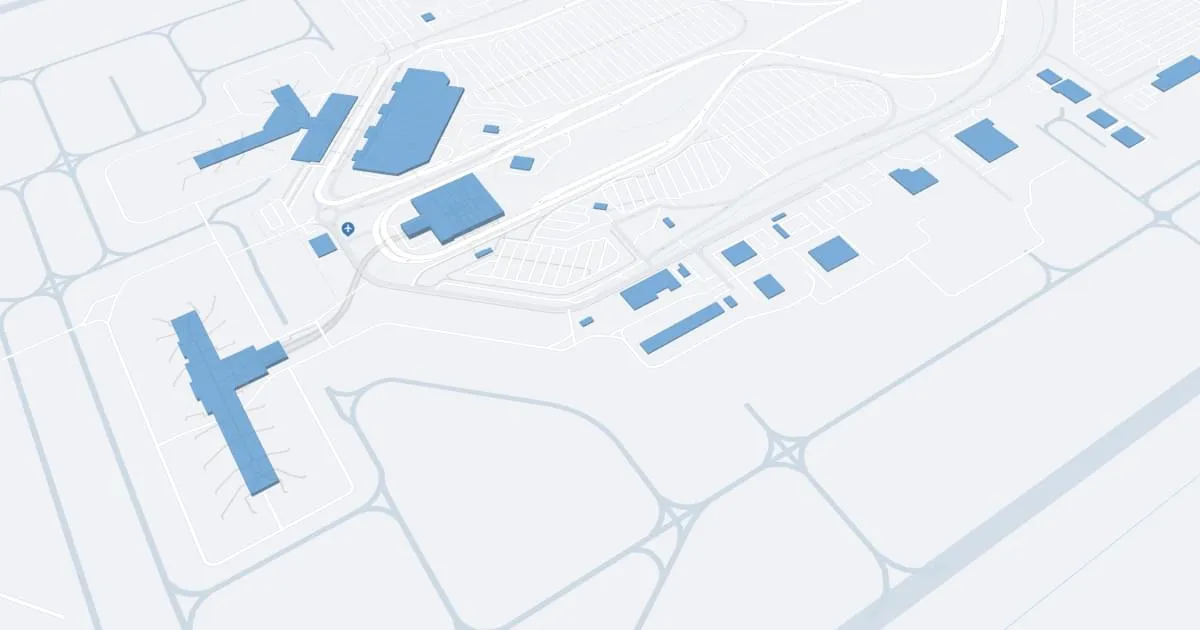
Sacramento International Airport (SMF), situated approximately 10 miles northwest of downtown Sacramento, California, serves as a vital conduit for air travel in the state's capital region. The airport accommodates a substantial flow of both domestic and international flights, making it an essential hub for residents and visitors alike.
SMF is organized into two main terminals, A and B. Terminal A, the smaller of the two, handles flights operated by airlines such as Delta and American Airlines, among others. Terminal B, opened in 2011, is a more modern facility and serves as the primary terminal for many airlines, including Southwest, which is one of the airport's major carriers. Both terminals boast architectural designs that emphasize spaciousness and natural light, creating a welcoming atmosphere for travelers.
The airport's layout is designed for convenience and efficiency, allowing passengers to navigate easily between terminals via a network of shuttles that operate regularly. These terminals are well-equipped with a variety of amenities to enhance the passenger experience. Dining options at SMF range from fast food and casual dining spots to restaurants offering local Sacramento cuisine, reflecting the area’s agricultural richness. Shopping opportunities are diverse, with outlets ranging from newsstands and travel essentials to local artisan products and luxury goods.
Passenger comfort is a priority at SMF, which offers several lounges, free Wi-Fi throughout the terminals, and numerous charging stations to keep travelers connected. For families, children's play areas and nursing rooms provide additional convenience. The airport is also committed to accessibility, ensuring that facilities like restrooms and shuttle services are fully accessible to travelers with disabilities.
Parking at SMF is straightforward, with options that cater to both short-term and long-term needs. Proximity parking lots are available near both terminals, and economical options are located further out, with frequent shuttle services connecting them to the terminals.
For transportation to and from the airport, SMF is served by major highways, making access by car convenient. Public transportation options include Yolobus, which provides regular services connecting the airport with various points in the region, including downtown Sacramento. Taxi services, along with app-based rides like Uber and Lyft, offer flexible and direct transportation options.
SMF is committed to sustainability, implementing initiatives to reduce environmental impact. These include energy-efficient buildings and a comprehensive recycling program, underscoring the airport's dedication to environmental stewardship.
Overall, Sacramento International Airport stands as a gateway that reflects the dynamic and diverse spirit of Sacramento, offering a streamlined, comfortable, and efficient travel experience for all passengers.
Sacramento Airport Weather 07/22/2026
Weather Forecast
Tonight
65
Clear

Wednesday
90
Sunny

Wednesday Night
58
Mostly Clear

Thursday
93
Sunny
Thursday Night
57
Clear
Friday
94
Sunny
Friday Night
58
Clear
Saturday
95
Sunny
Saturday Night
59
Clear
Sunday
95
Sunny
Sunday Night
57
Clear
Monday
94
Sunny
Monday Night
56
Clear