Kapalua Airport (JHM) | Terminal maps | Airport guide


Kapalua Airport Terminal Guides
View All JHM Guides-
JHM Airport Terminal
Open Guide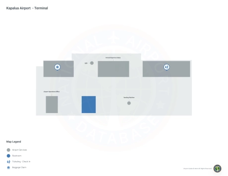
Kapalua Airport Information
-
Airport Address:
4050 Honoapiilani Hwy, Lahaina, HI 96761, United States -
Official Website:
http://hawaii.gov/jhm -
Contact Number:
(808) 665-6108
JHM Contact Information
-
Name:
MARVIN MONIZ -
Address:
KAPALUA AIRPORT -
Telephone:
(808) 872-3830
Kapalua Airport

Kapalua Airport (JHM), located in West Maui, Hawaii, is primarily for inter-island travel and serves as a convenient gateway to the scenic Kapalua and Lahaina areas. It is primarily served by 'Ohana by Hawaiian Airlines, offering direct flights to Honolulu that connect travelers to a wider domestic and international network. The terminal provides basic amenities including parking and car rental services to explore Maui's scenic attractions. JHM Airport is a must for travelers looking for a less congested alternative to Kahului Airport, supporting local tourism and providing easy access to Maui's famous resorts and natural beauty.
Kapalua Airport Weather 07/19/2026
Weather Forecast
Today
83
Partly Sunny and Windy
Tonight
72
Breezy. Partly Cloudy then Isolated Showers
Monday
83
Breezy. Scattered Showers then Mostly Sunny

Monday Night
73
Isolated Showers
Tuesday
83
Scattered Showers then Mostly Sunny
Tuesday Night
73
Isolated Showers
Wednesday
84
Partly Sunny then Mostly Sunny and Breezy

Wednesday Night
73
Mostly Cloudy and Breezy
Thursday
83
Partly Sunny and Breezy
Thursday Night
73
Mostly Cloudy and Breezy
Friday
83
Partly Sunny and Breezy
Friday Night
72
Partly Cloudy and Breezy then Mostly Cloudy
Saturday
83
Partly Sunny and Breezy